
LET'S CONNECT ON SOCIAL MEDIA:
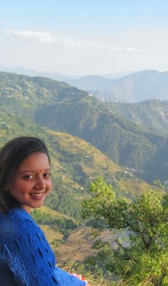
Winters have started drifting away. And spring is tiptoeing closer by the day. As I sit and write this in Manali, a sparrow tells me that soon it will be summer. Trees, mountains, and trails will open the path for us as the snow melts with the sun shining brightly. Summer, for us travel enthusiasts means adventure. It means long hikes and making way to the mountains that remain mostly inaccessible in winters. So here are five Himalayan treks that you just can’t miss this summer.
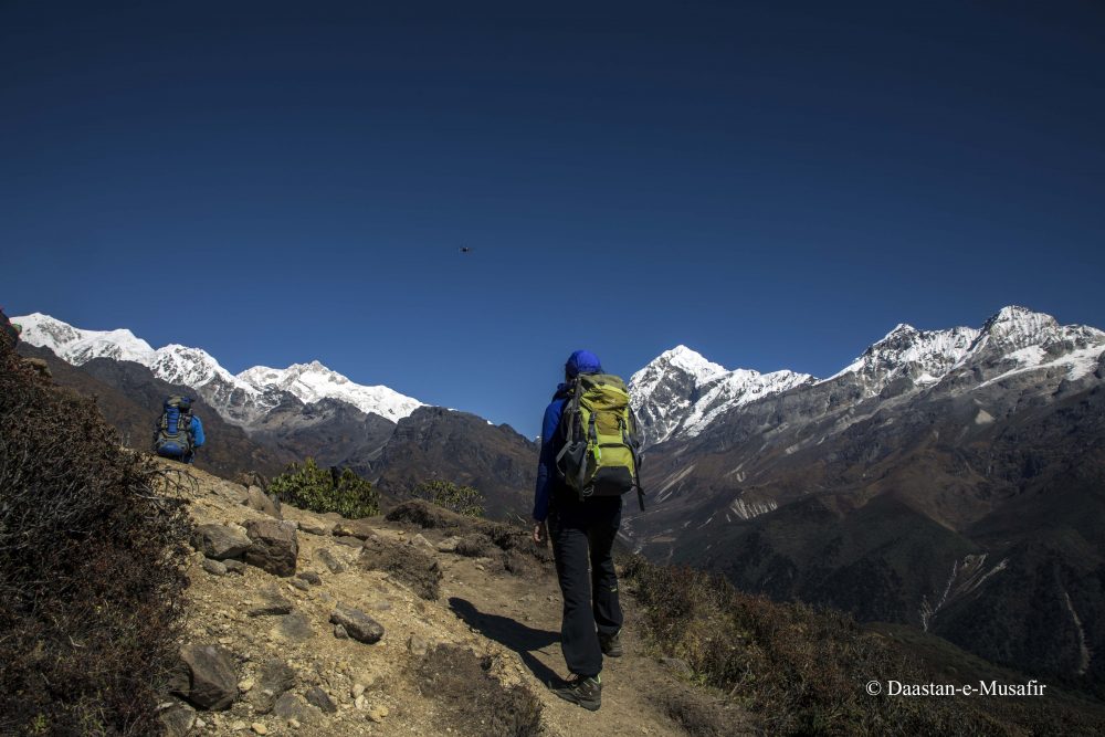
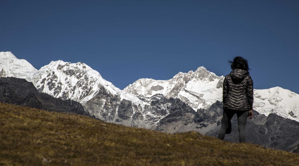
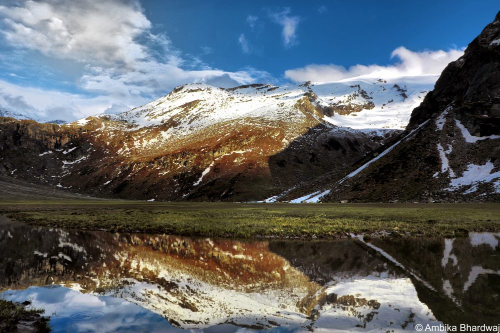
Wrapped in legends, Dzongri–Goechala is more than just a trek. Folklore has it that amidst the trails of this trek hides the gateway to Shangri–la, the Kingdom of Happiness. Shangri–la is the mythical kingdom where everybody is happy, far beyond the struggles of this world.
Once an old monk narrated the tale of Shangri– La to me:
There was an old monk. He was the sole possessor of a detailed map to the valley of Shangri–La. When power mongers who wanted to plunder the valley of happiness were informed about the map, they wanted to snatch it away from the old monk. However, the wise old monk, in order to save Shangri–La, decided to run away with the map and jumped off a cliff. Ever since then, we’ve lost our way to the Kingdom of Happiness. Legend has it that this gateway hides somewhere in the mountains of Sikkim and will only be revealed to the right person at the right time.
It is interesting to note that many people have “lost their way” on the Dzongri–Goechala trail; it gets me wondering if they were really lost or were they present at the right place to stumble upon the secret gateway.
I am not sure if you will believe this or not, but I have never seen a trail this enchanting. The luring jungle on this trail calls, the mountains on this trail move people to tears– there’s something about Dzongri– Goechala may be an air of magic!
Quick Highlights:
Region: Sikkim
Location: West Location
Maximum Altitude: 4986 meters
Best Time: March to June and September to November
Duration: 10 days
Grade: Difficult
Itinerary:
Day 1: Siliguri – Yuksom | Drive: 7 to 8 hours
Day 2: Yuksom (1750) – Sachen | Trek: 5 to 6 hours
Day 3: Sachen – Tshoka (3040 meters) | Trek: 5 to 6 hours
Day 4: Tshoka – Dzongri (3930 meters) | Trek: 6 to 7 hours
Day 5: Dzongri – Dzongri Top ( 4175 meters) – Dzongri –
Day 6: Thansing –Lamuney (4164 meters) | Trek: 2 to 3 hours
Day 7: Lamuney –
Day 8: Thansing – Tshoka | Trek: 6 to 7 hours
Day 9: Tshoka – Yuksom | Trek: 6 to 7 hours
Day 10: Depart to NJP/ Siliguri
Pro Tips:
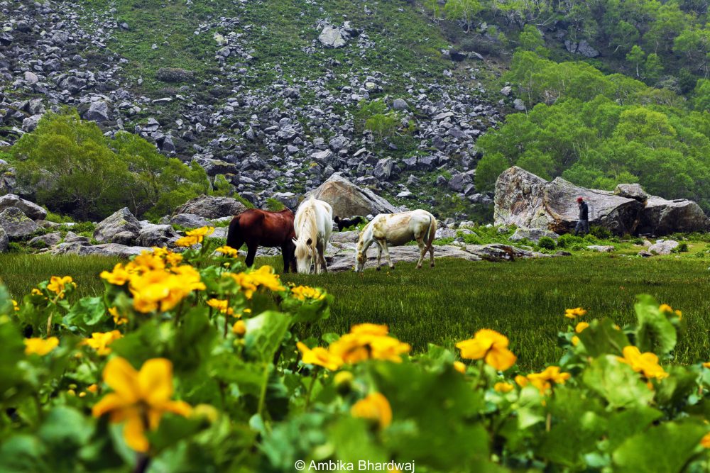
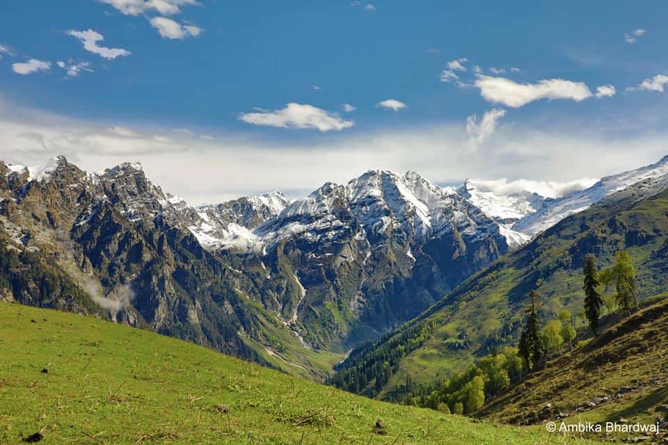
Himachal is every trekker’s paradise. The colorful prayer flags on mountains, lush forest and roaring rivers, keep the traveler’s heart humming. Out of the many treks in Himachal, Deo Tibba certainly has a vibe. Like the whole of Himachal, Deo Tibba basecamp trek is dear to every mountain enthusiast. Dense forest, majestic mountains, clear rivers, hanging glaciers, the postcard natural landscape; need I say more? The best part about this trek is that you will be hiking along Duhangan river, experiencing the confluence of Duhangan and Beas as you head towards the source of Duhangan (Chota Chandratal).
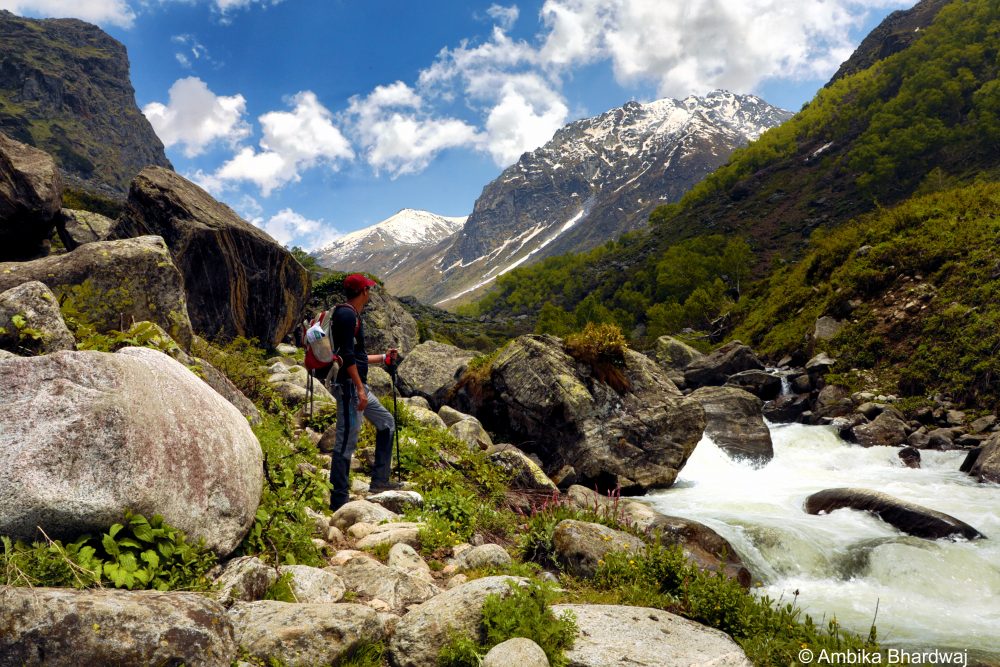
Himachal certainly has got it all, and Deo Tibba is precisely where one can live it all in one trek. Hiking around grazing pastures with innumerable sheep and the emerald blue water of Chota Chandratal (4,480 meters) with a magnificent view of the Deo Tibba peak (6, 001 meters) – is what makes this trek a winner of hearts.
Quick Highlights:
Region: Himachal Pradesh
Location: Manali
Maximum Altitude: 4800 meters
Best Time: May to October
Duration: 5 days
Grade: Easy with some steep patches
Itinerary:
Day 1: Manali (2050 meters)
Day 2: Manali (2050 meters) – drive to Jobra Naala – hike to Chikka (3100 meters) | Drive: 1 hour | Trek: 2 to 3 hours
Day 3: Chikka (3100 meters) – Seri (3900 meters) | Trek: 4 to 5 hours
Day 4: Seri (3900 meters) – Deo Tibba Base (4800 meters) – Seri (3900 meters) | Trek: 7 to 8 hours
Day 5: Seri (3900 meter) – Chikka (3100 meters) – Manali (2050 meter) | Trek: 5 to 6 hours and Drive: 1 hour
Pro Tips:
This trek is straight out of a Himalayan postcard. The cradle shaped valley is situated in the western Himalayas. It can be accessed through The Govind National Park, which also implies that it is home to wild alpine flora and fauna. By far, this is one of most romantic trails, I have ever experienced. Walking on this trail is a sheer joy. There are ancient Himalayan villages, little wooden bridges, and the turquoise blue water of Tamsa river seldom leaves your side. I trekked to the valley of Gods around half a decade ago, and yet if I close my eyes I can go back to it! Such is Har Ki Doon; it is one of those experiences that stays with you.
Quick Highlights:
Region: Uttarakhand
Location: Garhwal
Maximum Altitude: 4300 meters
Best Time: March to June and September to December
Duration: 7 days
Grade: Medium
Itinerary:
Day 1: Dehradun – Sankri (2000 meter) | Drive: 200 km/ 6 to 7 hours)
Day 2: Sankri (2000 meter) – Osla (2560 meter) | Drive: 30 minutes and Trek: 4 to 5 hours
Day 3: Osla (2560 meter) – Har ki Doon base Camp (3450 meters) | Trek: 5 to 6 hours
Day 4: Har Ki Doon basecamp (3450 meters) – Hata Valley (3850 meters) – Har Ki doon basecamp | Trek: 5 to 6 hours
Day 5: Har Ki Doon basecamp – Osla (2560 meters) | Trek: 4 to 5 hours
Day 6: Osla (2650 meters) – Sankri (2000 meter) | Trek: 4 to 5 hours and Drive: 30 minutes
Day 7: Sankri – Dehradun | Drive: 200 km/6 to 7 hours
Pro Tips:
No, this is not Hampta Pass! And this is precisely what makes Hampta Circuit so unique. The past few years stand witness to the rise of adventure travel, and suddenly Hampta Pass has become popular on the tourist grid. However, hiding in plain sight, right adjacent to Hampta Pass is Hampta Circuit. It’s an easy trek that unfolds into a breathtaking view of Dhauladhar, Pir Panjal, and Bara Banghal ranges. The trail is easy and walks us through walnut and oak trees along with the famous cannabis plantation.
Quick Highlights:
Region: Himachal Pradesh
Location: Manali
Maximum Altitude: 3100 meter
Best Time: May to October
Duration: 6 days
Grade: Easy
Itinerary:
Day 1: Manali (Jagatsukh)
Day 2: Jagatsukh – Buggi meadow (1900 meters) | Trek: 3 to 4 hours
Day 3: Buggi – Sorotu (2200 meters) Meadow | Trek: 2 to 3 hours
Day 4: Sorotu – Jogidugh(2800 meters) | Trek: 6 to 7 hours
Day 5: Johidugh – Kharmandari (2600 meters) | Trek: 5 hours
Day 6: Kharmandari – Panduropa (2000 meters) | Trek: 4 hours
Pro Tips:


Thank you for such a magical way of describing these Himalayan treks! And for the safety tips too. Trekking was never for the weak of heart and body, but being able to explore and see these majestic views are priceless.